Irazu Volcano
The Iztarú tribe, who lived on the slopes of the volcano, knew it as 'Irazu' meaning ‘thundering mountain’; a fitting name for the volcano that has been erupting for the last 500 years. Irazu last erupted during President John F. Kennedy's visit in1963 spreading ash from Costa Rica to Nicaragua.
Quick Facts
- Location: Irazu Volcano National Park
- Altitude: 11,260 feet above sea level
- Hours: 8 a.m. to 4 p.m.
- Entrance Fee: $15 per adult (above 13 years old); $5 per child
- Parking Fee: $2 - $5 USD
- Last Entry Time: By 2 p.m. Crater's entrance; by 1 p.m. in Prusia's entrance
Loading gallery...
See Also
Irazu Volcano National Park
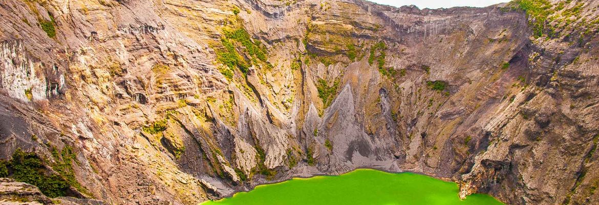
Irazu Volcano National Park craters' resemble a moonscape: a vast expanse of grey dust and rock with a green lagoon at its center, which swells and dries up with the seasons. One of Costa Rica's active volcanoes, ...
ContinueCartago
When Spanish governor Juan Vasquez de Coronado founded the city of Cartago in 1563, he claimed that he’d never seen a more beautiful valley. The verdant mountains and fertile land were soon claimed as Costa Rica’s ...
ContinueLast updated: Oct 21, 2023